The scramble to lodge development applications ahead of the deadline of the FNQ2031 Regional Plan in 2009 saw at one stage 35 proposals in the Mission Beach area referred to the Federal Environment agency to be assessed under the EPBC Act.
To date, except for the then minister Peter Garrett's 'clearly unacceptable' decision on Lot 66, all developments assessed have been approved with various conditions and offsets.
If the funds cannot be found for a buyback of Lot 66 the proponent has pledged to keep lodging new applications until there is an approval.
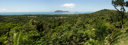
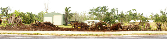
The overwhelming number of applications highlighted the shortcomings of planning on all levels of government which allowed for destruction and fragmentation of some of the most well developed coastal rainforest in the world such as the development pictured (right). Although the developer was fined approximately $40,000 for illegal clearing while referred to the federal environment agency. the proposal was subseqently allowed to proceed without being made a controlled action under the EPBC Act.
There are still more developments entitled to be assessed under the old local planning schemes which offer little or no protection for our high biodiversity area or for good quality agricultural land (GQAL), the mainstays of our economy.
There are still more developments entitled to be assessed under the old local planning schemes which offer little or no protection for our high biodiversity area or for good quality agricultural land (GQAL), the mainstays of our economy.
Some of our most productive land on optimal volcanic soil has been approved for housing with a lot more still available within the urban footprint.
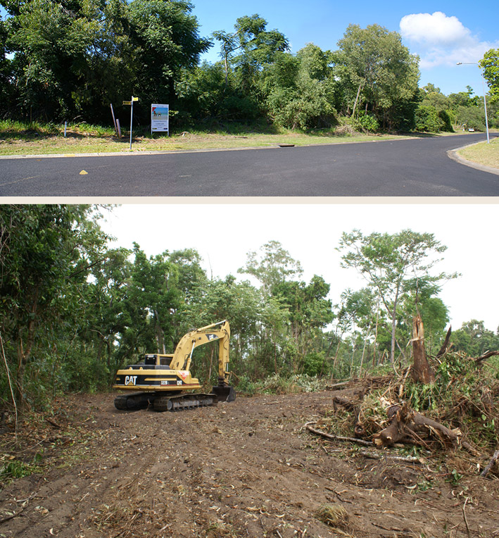
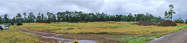
The Council will be deciding in the near future on a residential development application on GQAL at Carmoo.
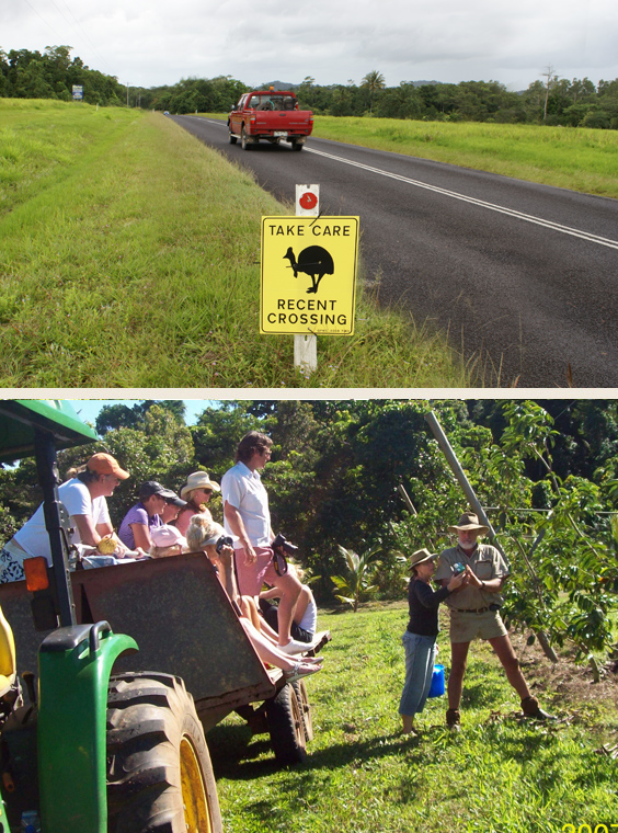
This is a location where there have been 12 cassowary deaths from road strike (see photo below).
Some rural land owners who have reduced farm sizes such as this one by subdividing and selling off lots for housing claim they are no longer viable for farming.
The Council will be deciding in the near future on a residential development application on GQAL at Carmoo.
This is a location where there have been 12 cassowary deaths from road strike (see photo below).
Some rural land owners who have reduced farm sizes such as this one by subdividing and selling off lots for housing claim they are no longer viable for farming.
Current farm practices by innovative farmers are proving this to be untrue. As one farmer states;
'The new plan ( FNQ 2031 Plan) limits rural subdivision to 60 hectares which has merit in some ways but totally lacks knowledge and vision in others. As horticultural growing systems become more efficient the need for big areas becomes less pressing"
Will this council, with a majority of its representatives rural land owners make a decision based on old farm practices?
Or will it be forward thinking enough to see the importance and value of retaining good quality agricultural land not only for much needed future food resouces but the economic opportunities it offers through farm tourism?
The glut of house blocks already available for4 sale , including lifestyle lots, demonstrates there is no need for more.
A byproduct of retaining the lot as farmland is that there would not be an increase of threats to the already endangered cassowary created by a development in the highest road mortality area of Missison Beach by the introcduction of more vehicles, human interaction, and exotics, including dogs.
Changes the latest development boom bought to Mission Beach shocked the local community and have been overshadowd and exacerbated by the events of March this year with the advent of cyclone Yasi.
Opportunistic clearing, excessive clearing associated with waterway cleaning, 'tidying' of natural areas, a 'landscaping' approach taken in important habitat corridors such as at Wongaling Creek and the foreshore and the incremental removal of native vegetation on public land has resulted, in many cases, of permanent loss in scenic amenity, floristic diversity and community identiy.
Opportunistic clearing, excessive clearing associated with waterway cleaning, 'tidying' of natural areas, a 'landscaping' approach taken in important habitat corridors such as at Wongaling Creek and the foreshore and the incremental removal of native vegetation on public land has resulted, in many cases, of permanent loss in scenic amenity, floristic diversity and community identiy.
In the absence of detailed planning and expert advice the loss is likely to continue to occur. The example above at the entrance to the Mission Beach village shows large trees on the public nature strip removed for an access driveway. The strip is now 'landscaped' with selected garden plants and shrubs.
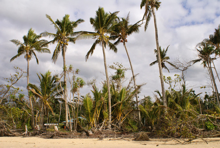
The same incremental loss of the natural vegetation on the foreshore is happening in many places where housing is present as the high diversity of rainforest species that traditionally grow down onto the beaches are now being replaced by a monoculture of coconuts.
Lost also are the many animals and birds that rely on the natural vegetation for their food, refuge and reproduction.
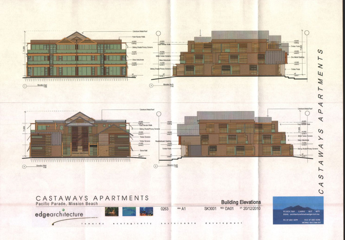
A development application by Castaways to extend the three storey limit into the residential area as part of the motel expansion was withdrawn before determined by Council.
Many residents in the vicinity were concerned about the impact the large block of extra units would have on breezeways, vistas and the residential amenity they bought into.
Many residents in the vicinity were concerned about the impact the large block of extra units would have on breezeways, vistas and the residential amenity they bought into.
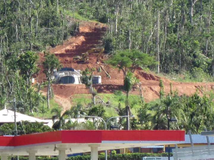
Photo courtesy Jennie Cameron
Officers from the compliance branch of the federal environment agency visited Mission Beach as a response to reports of native vegetation clearing after the cyclone. One of the sites still under investigation is the recent approval for residential development at Explorer Drive South Mission Beach.
The owner of another property (right) has entered into an agreement with the government to undertake rehabilitation of the remnant vegetation that was removed at the highly visible site on the hillside at Wongaling Beach. It is hard to imagine how this massive excavated and benched area can be successfully replanted but it will be interesting to watch the progress.
There have been several different cassowaries sighted on properties just below where the clearing occured and QPWS has intervened, relocating at least one bird from this area.
The controversial development at the end of the bush track along Garners Beach is in the final stage of assessment under the EPBC Act. Local conservation group, C4, fought against a development on this site in the mid nineties. The current proposal for 11 residences on the rocky knoll at the end of the road would forever compromise the wilderness aspect of the location. The increase of vehicle movements associated with such a development would have a significant impact on the relatively safe population of cassowaries that regularly cross local roads.
Traffic associated with the development from the construction phase of each of the extra 10 houses to ongoing normal access for provisions and social enagagements, service vehicles including garden and house maintenance, visitors etc will all need to travel on roads through cassowary habitat, some of which are still unsealed.
An upgrade of the esplanade track would require significant destruction of critically endangered littoral rainforest.
It is stated in the application, the current house is a template for another 10 which are positioned to dominate the level ground on the lot. The house may have won awards for some innovative energy design features but with a footprint said to occupy approximately 1000 sq mtrs, the environmental credentials do not extend to the impact on this particular site. The style of development is out of character for the low density rural conservation area and would introduce unnacceptable risks to the approximately 12 known cassowaries in the Garners Beach/Bingil Bay area. Read more here.
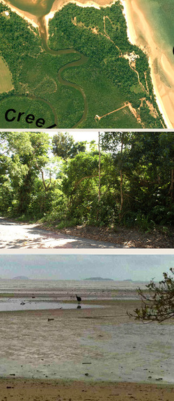
Photos
top; Size of footprint of current dwelling/s
middle; Littoral rainforested bush track
bottom; Cassowaries still access beaches in the near wilderness area (photo Susan Hawthorn)
Comments are due on 3 October. If you would like more information on how to make a comment on this development please contact [email protected]
Traffic associated with the development from the construction phase of each of the extra 10 houses to ongoing normal access for provisions and social enagagements, service vehicles including garden and house maintenance, visitors etc will all need to travel on roads through cassowary habitat, some of which are still unsealed.
An upgrade of the esplanade track would require significant destruction of critically endangered littoral rainforest.
It is stated in the application, the current house is a template for another 10 which are positioned to dominate the level ground on the lot. The house may have won awards for some innovative energy design features but with a footprint said to occupy approximately 1000 sq mtrs, the environmental credentials do not extend to the impact on this particular site. The style of development is out of character for the low density rural conservation area and would introduce unnacceptable risks to the approximately 12 known cassowaries in the Garners Beach/Bingil Bay area. Read more here.
Photos
top; Size of footprint of current dwelling/s
middle; Littoral rainforested bush track
bottom; Cassowaries still access beaches in the near wilderness area (photo Susan Hawthorn)
Comments are due on 3 October. If you would like more information on how to make a comment on this development please contact [email protected]