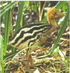
Stripey
|
Juvenile
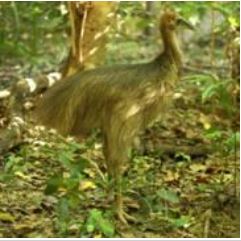
|
Subadult
|
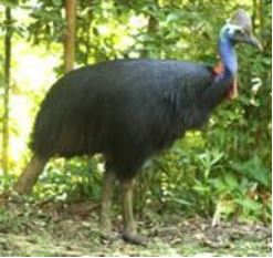
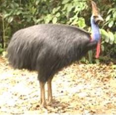
Adult male
|
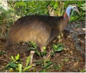
Adult female
|

Share your sightings on our facebook group
Sighting reference maps
based on roadside post numbers
based on roadside post numbers
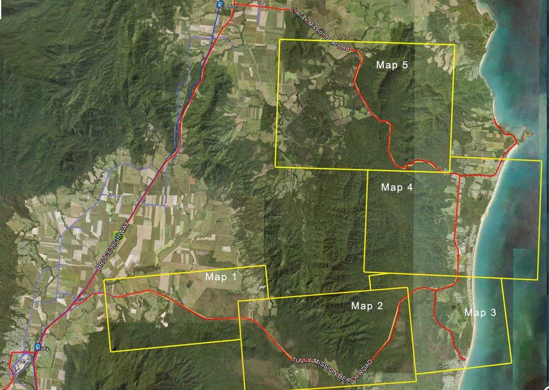
Overview
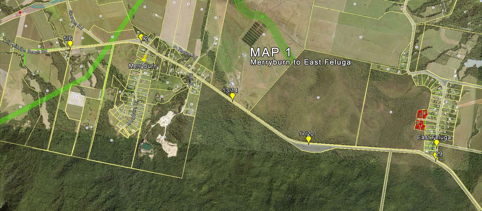
Map 1 Merryburn to East Feluga
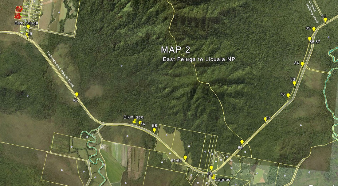
Map 2 East Feluga to Licuala National Park
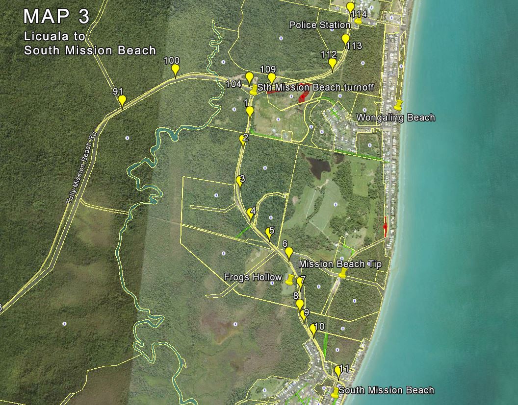
Map 3 Licuala NP to South Mission Beach
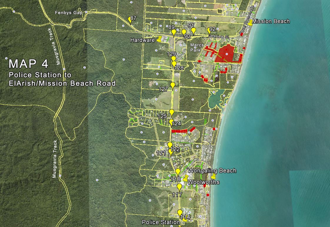
Map 4 Police Station to El Arish/Mission Beach Road
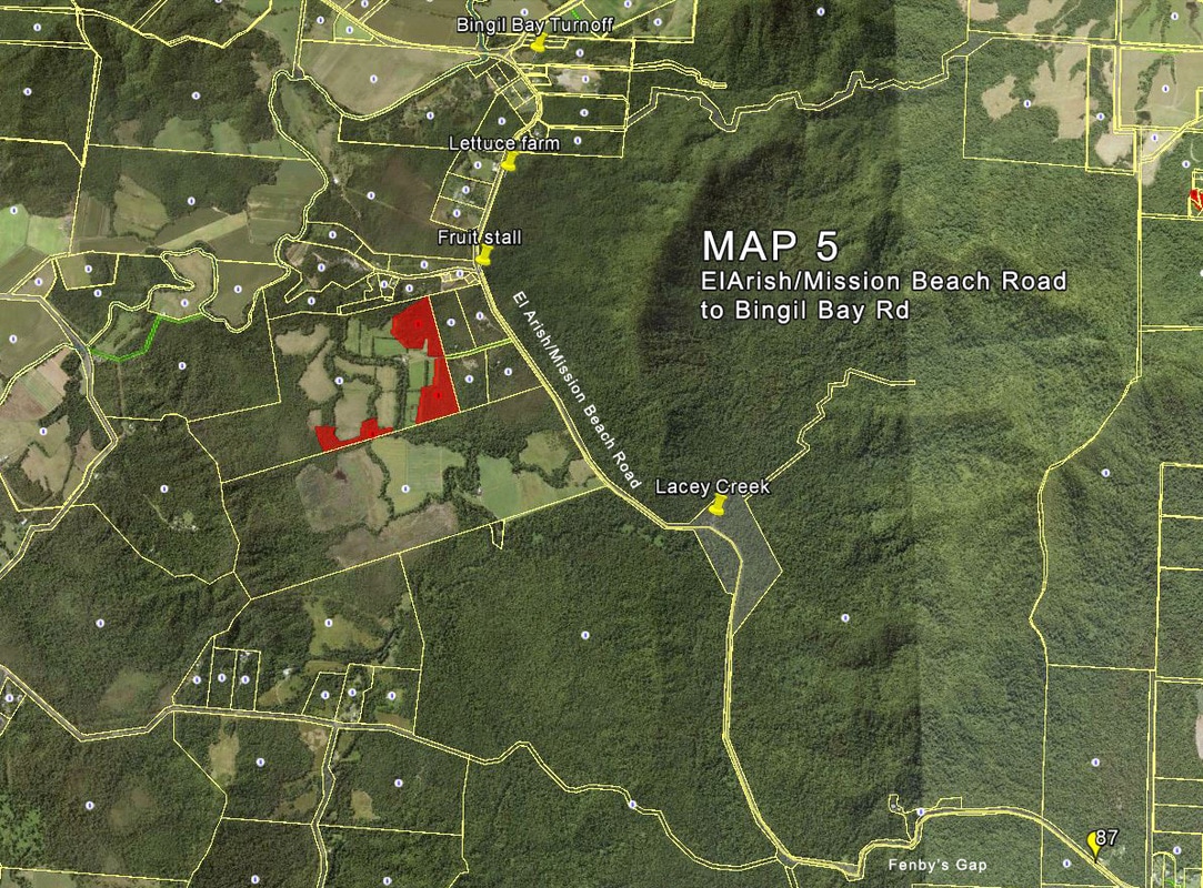
Map 5 El Arish/Mission Beach Road to Bingil Bay Road