How to see a cassowary in the wild |
|
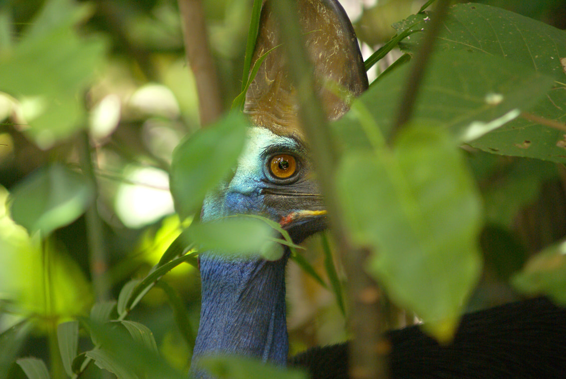
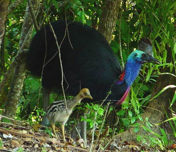
The bright colours of a cassowary are a natural camouflage that allows them to become 'invisible' in the dappled light of their natural habitat - the tropical rainforests of North Queensland. They prefer not to be seen so they will more often stand still when people use the many walking tracks at Mission Beach.
Cassowaries are 'spotted' regularly out in the open on roads and urban environments as they move from one fragmented patch of rainforest to another. Visitors are discouraged from driving around to look for them. This not only increases traffic on the road but can cause local driver impatience increasing the risk of cassowary driver/interaction. When out in the open, cassowaries are no longer 'invisible' and their behaviour changes. Cassowaries might approach people if they have been hand fed. Once within the dappled light of the rainforest however their behaviour is quite different. It is here they can be observed 'in the wild'. |
Where to go to see a cassowary
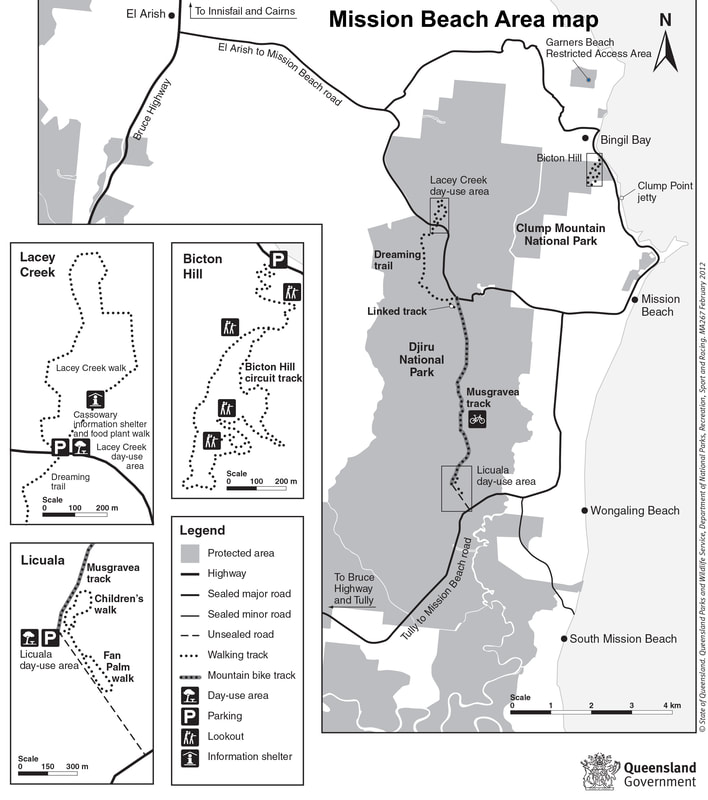
We recommend taking an early morning walk in one of the walking tracks close to Mission Beach village. Cassowaries roost from dusk to dawn so are on the move in first light in the morning. Maybe take your morning coffee or other and head off to the Licuala or Musgravia track (see below). Walk along the track and find a spot to sit (or stand) quietly next to a tree or shrub and wait. Don't forget to take mossie guard :-)
What to do when meeting a cassowary on a walking track
Cassowaries will be aware of you if you are moving around and will stand still assuming you can't see them. Once you are quiet you will easily hear a (cassowary or two) walking around if the ground cover is reasonably dry. Juveniles can be inquisitive. Should you be approached by a bird avoid eye contact In the very unlikely event a bird persists in approaching you or if you notice it standing very tall, do not look it in the eye, back away very slowly placing a barrier of trees between you and the bird. Never run away from a cassowary. Like Emus it triggers a response to run also. If a cassowary is ignored it generally loses interest very quickly and goes on its way.
If by chance you don't get to see a bird at Mission Beach and you have time to take a trip to Etty Bay you may be lucky to see one of a number of birds that regularly visit the beach. These birds unfortunately are habituated to people. While the adult birds will move on if they know you do not have any food, younger birds can be unpredictable and demanding. We don't recommend taking a picnic onto the beach and if a bird approaches you while eating at a table, cover the food and avoid eye contact.
If by chance you don't get to see a bird at Mission Beach and you have time to take a trip to Etty Bay you may be lucky to see one of a number of birds that regularly visit the beach. These birds unfortunately are habituated to people. While the adult birds will move on if they know you do not have any food, younger birds can be unpredictable and demanding. We don't recommend taking a picnic onto the beach and if a bird approaches you while eating at a table, cover the food and avoid eye contact.
It is an awesome experience seeing a cassowary in the wild.
Happy cassowary spotting.
Please share your experiences with us on our facebook page.
Happy cassowary spotting.
Please share your experiences with us on our facebook page.
Local Walking tracksBICTON HILL WALK
4 KM - 1 -2 HOUR WALK
Bicton Hill Walk is 4.5 km north of of Mission Beach Village on the Bingil Bay Road.
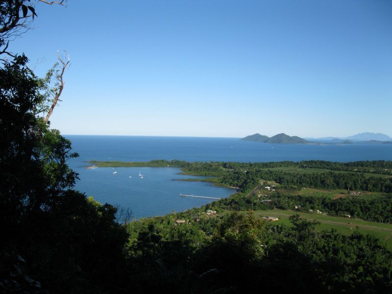
This four kilometer circuit track up Bicton Hill at Bingil Bay is in the Clump Mountain National Park, and has unsurpassed views and an enormous variety of rare rainforest plants and animal life, one of which is the unusual nesting site of the buff-breasted paradise-kingfisher - They nest in termite mounds here in summer.
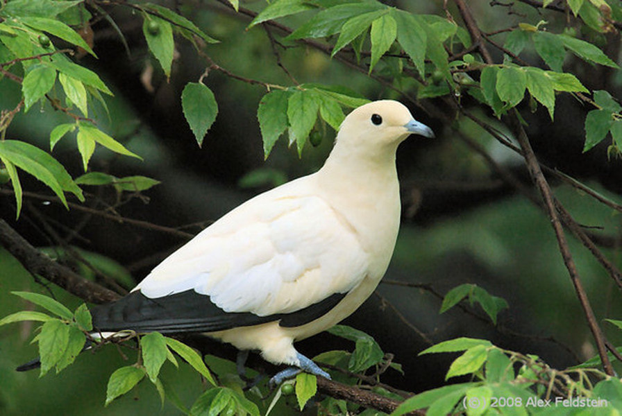
Between October and March, watch the evening spectacle of migratory pied imperial-pigeons returning to the islands after foraging for food on the mainland.
Sturdy plants on the eastern side such as brush box and swamp mahogany are able to withstand the high winds and occasional cyclone. On the western side the vegetation changes. Look for strangler figs, Alexander palms and cycads.
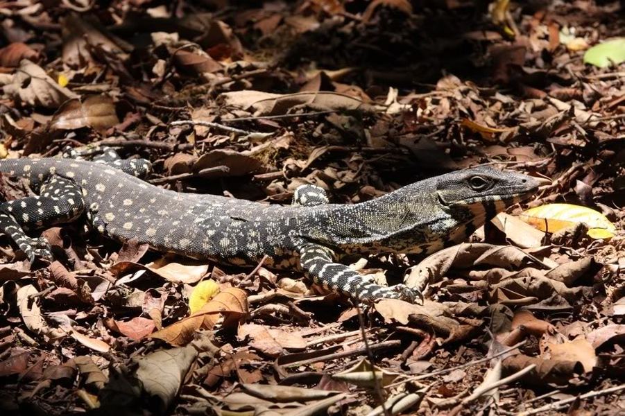
One of the famous animals on the hill are the Lace monitors, who have the unusual habit of depositing their eggs in termite nests in trees. The constant temperature inside the nests helps incubate the eggs. Bicton Hill is also home to marsupials such as the nocturnal striped possum.
The walk has easy gradients accessible to all areas, with seating at each of the four lookout points. Access to this track is via the carpark - picnic area at Bingil Bay. On completing the walk you may like to swim from one of the deserted beaches across the road (Alexander Drive), or walk along the Drive to the north and at the corner of Bingil Bay Road and Cutten Street are toilet facilities.
ULYSSES LINK AND THE CUTTEN BROTHERS’ WALKING TRACKS
1.5 KM - 30 MINUTES
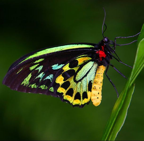
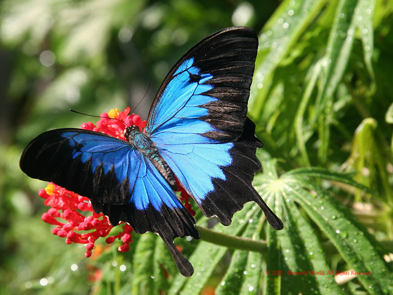
The Ulysses Link walking track commences on the beachfront at Mission Beach Village. It is named for the brilliant blue Ulysses butterflies, the 1.5km Ulysses Link Walking Track winds its way along the breathtaking foreshore.
The history of Mission Beach has been interwoven along the walk with indigenous and historical stories expressed through mosaics, carvings and ceramic sculptures created by local artists.
The track meanders north to Clump Point where it meets up with The Cutten Brothers’ Walking Track.
The Cutten Brothers’ Walking Track commemorates the first white settlers who came to Mission Beach area in 1882 and settled at Bingil Bay, where they farmed mangoes, bananas, pineapples, coffee, citrus fruit and coconuts. They also manufactured their own coffee. Produce was shipped south on cargo-boats.
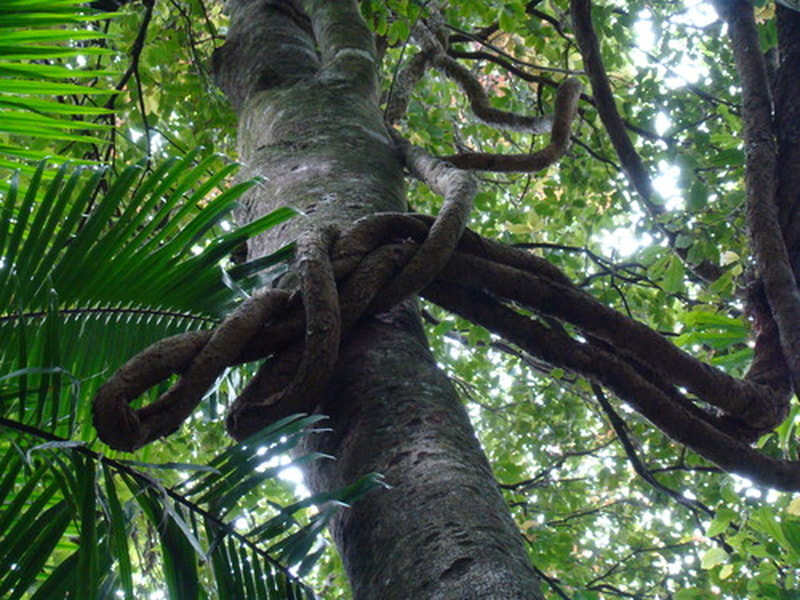
The forest on the Cutten Brothers’ Walking Track is known as Complex Mesophyl Lowland Vineforest and is the only surviving remnant left at sea level. This beautiful cool green world is filled with Epiphyte bird nests, Elkhorne ferns, Lianes, Feather leaf tree fern, Cordyline, huge trees with plank buttresses covered in mosses and plants known as Cauliflory.
It is the home to the Cassowary, Scrub Turkey, parrots, wallabies the shy Betong and many small mammals and reptiles. It is also the habitat of dozens of different species of birds and butterflies.
LACEY'S CREEK WALK
1.5KM - APPROX. 45 MINUTES
Lacey’s Creek Walk is approximately 7.5km from Mission Beach Village along the Mission Beach – El-Arish Road. Lacey’s Creek offers you crystal clear waters running over pebble stones. There are picnic tables, BBQ’s and toilet facilities for your convenience.
This walk is best appreciated when walked in an anti-clockwise direction. Starting from the Cassowary Information Shelter, here you can learn about cassowaries, which are frequently seen in the area.
Cassowaries rely on the rainforest for their food and shelter. The fruit of over 230 rainforest plants provides them with a large menu to choose from. Signs identify a variety of the food plants growing near the cassowary information shelter.
The track passes through rainforest and exits at the picnic area near the car park. Signs along the track provide information about the evolution of various plants and animals. About half way round, a viewing platform allows walkers to peer into a calm pool of Lacey Creek and spot saw-shelled turtles and fish of various types. Signs help with identification.
Cassowaries are often spied at Lacey’s Creek.
MUSGRAVEA TRACK (TRACK BETWEEN LICUALA AND LACEY’S CREEK WALKING TRACKS)
6 KM – ONE WAY – APPROX. 2.5 HOURS
This longer track is a multi-use track for walkers and mountain-bike riders. It is the only track in Djiru National Park where bicycles are permitted.
This mainly flat track is suitable for dry weather access and requires a medium level of fitness. It follows an old forestry road used in the 1960s and 1970s to haul timber from South Mission Beach to the El Arish timber mill. The track heads north from the car park at the Licuala day-use area and exits on to the El Arish–Mission Beach road about 2 km east of the Lacey Creek day-use area. For safety reasons, the old vehicle bridges have been removed and detours to the two creek crossings have been marked for walkers and cyclists. Bicycles will have to be carried down several steps, through the creek and up several steps at each creek crossing. Creeks in this area are subject to flash flooding and caution should be exercised.
The Musgravea track and the Dreaming trail join shortly before the road exit
LICUALA FAN PALM WALK
1.2KM - APPROX. 30 MINUTES
Licuala Fan Palm Walk is accessed from the Tully –Mission Beach Road, approximately 1km after the South Mission Beach turn off heading towards Tully from Mission Beach. There is approximately 1 km of unsealed road to the car park. The walk commences from the car park.
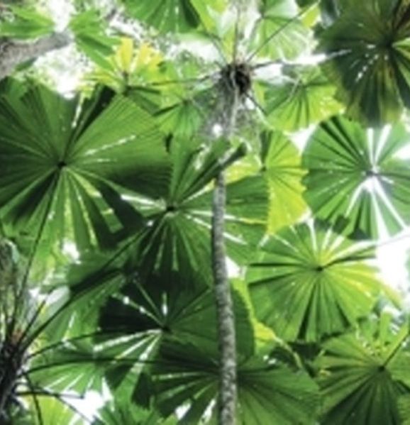
Take along Morning Tea and sit amidst the lush greenery of Licuala Fan Palms. This is a spectacular walk featuring a 10 -15 metre high canopy of Licuala Fan Palms. Mission Beach has approximately 50% of the remaining Fan Palm Forest in Australia. Their fleshy orange fruit is a favourite food of the elusive cassowary.
The walk is a flat easy walk and there are numerous name plaques to ease the curiosity explaining many of the features of the rainforest including cassowaries, vines, epiphytes, strangler figs, ferns, water and nutrient cycling. At the southern end of the loop there is a special 536 metre Fan Palm Boardwalk.
The Children’s walk is approximately 350 metres where by following the Cassowary footprints, the children can view a Cassowary nest and eggs.
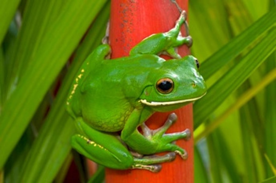
You may see the rare Cassowary, the famous iridescent blue Ulysses Butterfly, Green Tree Frog, Scrub Turkeys or Wallabies. Licuala National Park is on the Mission Beach to Tully road.
There are no cassowaries on Dunk Island but the island walkings tracks are well worth the visit.
DUNK ISLAND
The gently-rising hills of the Family Islands contrast with the jagged and lofty profile of Hinchinbrook Island, which dominates the southern horizon. Dunk Island, like the other Family Islands, is cloaked in a mosaic of dense rainforest in protected gullies and wet slopes. Eucalypt forest, with an understorey of palms, occurs on drier more exposed ridges.
The Family Islands lie within the traditional sea country of the Bandjin and Djiru Aboriginal peoples, who, for tens of thousands of years, have collected, gathered and hunted the rich marine and island resources for food and materials. Today they retain a strong connection to these islands. Lieutenant James Cook named Dunk Island in 1770 but it is best known from the writings of the 'beachcomber', E.J. Banfield. Living on Dunk Island from 1897 until 1923, Banfield wrote four books about the island's natural and cultural history.
Dunk Island offers a range of walking tracks which allow exploration of the island's famed natural history and rediscovery of its fascinating past. Take an easy stroll through the rainforest to a secluded beach or embark on a climb to the summit of Mount Kootaloo. (The distances and times below are calculated for walks beginning on Dunk Island Spit).
MUGGY MUGGY BEACH — 3 km return (70 mins)
Grade: easy
From the spit, walk to the north-east end of the beach to the start of the walking tracks. This pleasant walk winds through rainforest, coastal woodland, and mangroves before arriving at Muggy Muggy Beach. At this picturesque sandy cove, sheltered behind a rainforest clad headland, enjoy a swim and snorkel before returning along the same track. Access to this walking track may be affected by tidal influences at certain times.
MOUNT KOOTALOO — 7 km return (3 hrs)
Grade: moderate
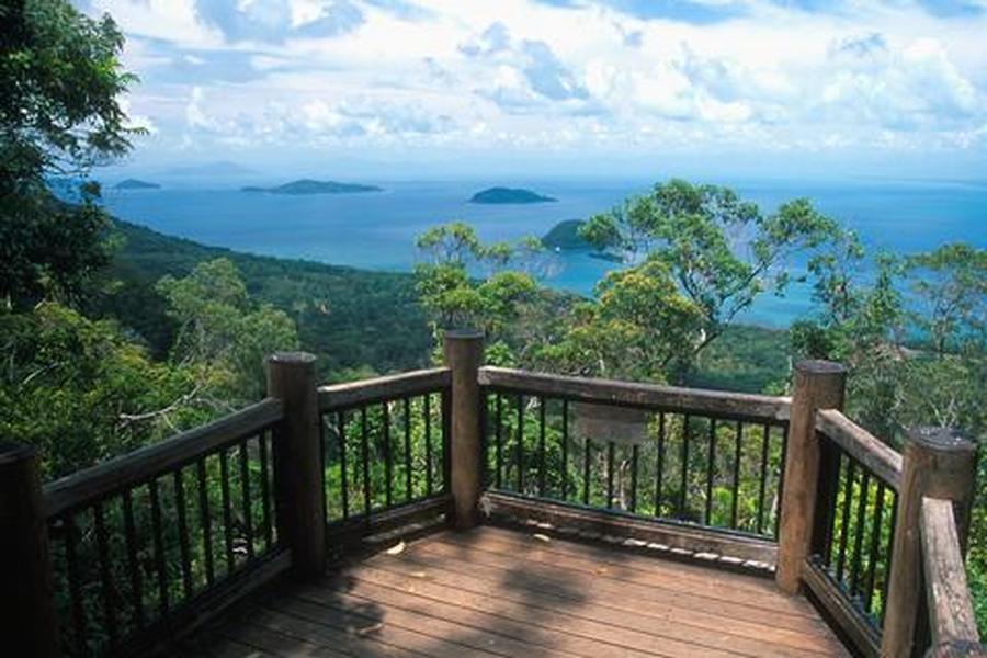
From the spit, walk to the north-east end of the beach to the start of the walking tracks. This more strenuous walk winds up a steep track to the 271 m summit. Cyclone-damaged rainforest on the lower slopes allows glimpses over the island and reefs as the track ascends. On the upper slopes, the forest opens out and eucalypts emerge through the canopy. Near the summit, a short branching track leads to a lookout, which offers spectacular views over the Family Islands and nearby mainland. Near the lookout, the remains of No. 27 Radar Station, built during World War II, are slowly being reclaimed by the rainforest. The track continues around the summit, rejoining the main track and returning to the beach. Access to this walking track may be affected by tidal influences at certain times.
ISLAND CIRCUIT - 9.2 kilometres (3 hrs)
Grade: moderate
From the spit, walk to the north-east end of the beach to the start of the walking tracks. Mt Kootaloo, you’ll pass through the magical Palm Valley and then onto Coconut Beach. Not for the faint hearted, this challenging walk will introduce you to Dunk Island’s lush green rainforest where you are likely to encounter the many different species of birdlife.
The islands support many species of birds, insects, reptiles and mammals. The brilliant blue Ulysses butterfly has become a symbol for Dunk Island. The fringing reefs surrounding each of the islands are home to a diversity of reef life. Extensive seagrass beds lie between the islands providing important feeding grounds for sea turtles and dugong.
Upon finishing your walks, you can unpack the picnic in the Day Use Area where you will find toilet and BBQ facilities and spend the rest of the day relaxing under the shade of the palm trees.
Access to Dunk Island via Quick Coast, private boat, hire boat, or charter boat
Information courtesy Mission Beach Holidays
